Geotag Photos
Binimise’s Geo-tagged Photo Capture Software allows teams to take photos with automatic GPS coordinates and timestamps, ensuring every image is traceable and verified. Whether used for field inspections, waste collection monitoring, asset verification, or service completion proof, the system helps establish image authenticity and enhances accountability. All geo-tagged images are automatically linked to specific tasks, locations, and users within your workflow, making it easy to review visual records for audits, reports, and compliance — directly from a central dashboard.
Schedule a Call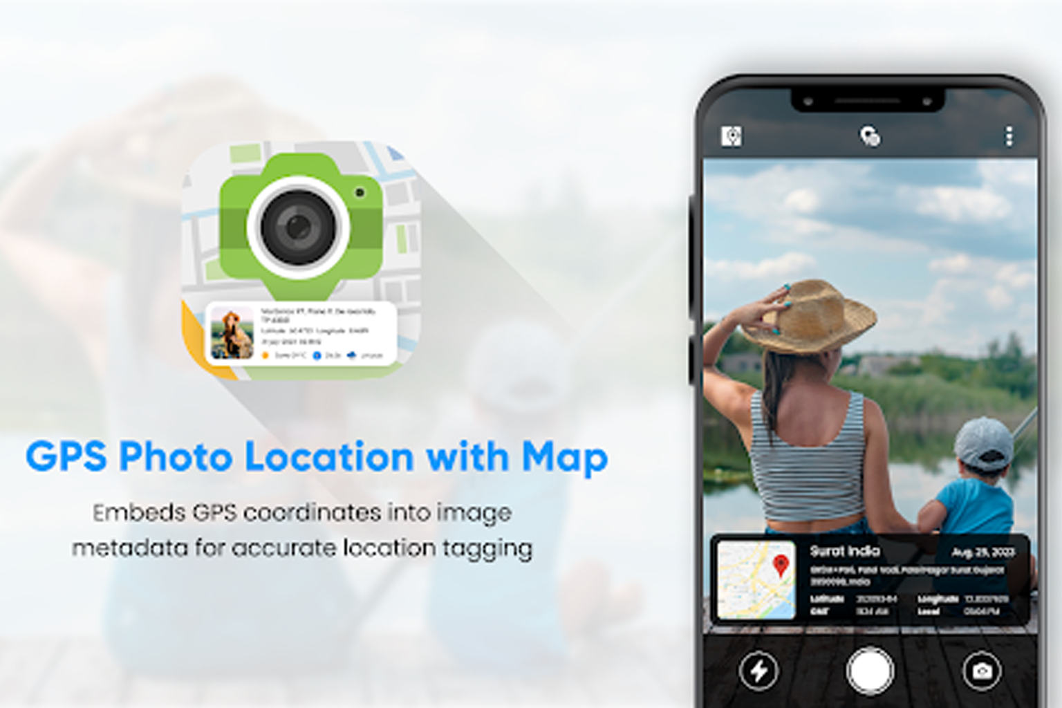
About Binimise Features
Monitor Vehicles and Staff in Real-Time
Ensure optimal operational efficiency by tracking the real-time location and status of your waste collection vehicles and staff. Stay informed and manage resources effectively.
- Vehicle & Staff Tracking
- Track & Trace from Anywhere
- Alerts & Reminders

Enhance Efficiency with Automated Processes
Automate routine tasks to increase efficiency and reduce manual effort. Leverage advanced technology to streamline operations and improve productivity across your waste management activities.
- RPA Automation
- Customized Mobile Apps
- Alerts & Reminders
Gain Insights with Advanced Reports and Analytics
Leverage detailed reports and advanced analytics to optimize your waste management operations. Make informed decisions and enhance performance with robust data analysis.
- Reports & Analytics
- User Access Control
- Customized Mobile Apps
Connect with Us
Have questions or need a custom solution? Our team at Binimise is here to help. Whether you're exploring our fleet tracking, waste management, field staff tracking or RFID-based systems, we’re just a message away. Reach out today — let’s make your operations smarter, simpler, and more efficient.
Feel Free to Contact Us, Get In Touch
We're here to assist you in any way we can. Whether you have questions, feedback, or just want to say hello
Location
Plot No. 402, Paika Nagar Lane 1, Unit 8, Bhubaneswar,
Odisha, 751008
Email Address
support@binimise.com
Make A Call
+91 123 456 789
Get in-depth reporting with
Real Time Reporting Dashboard
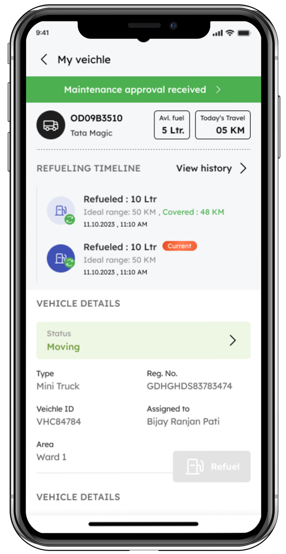
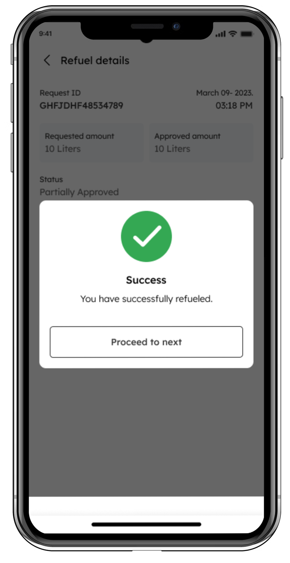
Fuel Filled Report
Track every drop accurately. BlackBox Fuel Monitoring delivers 99.5% precise reports, detailing when and where fuel is filled in your trucks.
Fuel Filled Report
Track every drop accurately. BlackBox Fuel Monitoring delivers 99.5% precise reports, detailing when and where fuel is filled in your trucks.
Fuel Filled Report
Track every drop accurately. BlackBox Fuel Monitoring delivers 99.5% precise reports, detailing when and where fuel is filled in your trucks.
Fuel Filled Report
Track every drop accurately. BlackBox Fuel Monitoring delivers 99.5% precise reports, detailing when and where fuel is filled in your trucks.
FAQ
Geo-tagged photos are images that include GPS coordinates and timestamps, verifying where and when the photo was taken.
Using your mobile device’s GPS, Binimise captures location and time data automatically when a photo is taken through the
app.
They’re ideal for inspections, fieldwork, complaint closures, property tagging, and audit trails in municipal and
corporate workflows.